
CPT has periodically explored purchasing a large tract of land in Montana to construct and operate a service dog facility that would educate animals for domestic clients residing throughout the USA and Canada. Since the Western USA in the Mountain time zone contains more economical land purchase opportunities than in the Eastern time zone or along the Pacific shore, CPT wishes to investigate specific locations that may meet CPT’s business objectives.
Amongst those potential locations are the Hi-Line and mountains of Western Montana. Unfortunately, Covid put a delay in previous travel plans- or should we say rules regarding Covid- as CPT’s Mark Spivak refused to fly while mask rules remained in effect. However, with mask rules expired, relaxed regulations facilitated fruition of the excursion. During the journey, Mark evaluated the potential of a service dog kennel in Montana and engaged in multiple rigorous outdoor activities. Below is a travelogue/blog of Mark’s journey to the Great Plains and Rocky Mountains of Western Montana.
Atlanta is known for its horrific traffic. Multiple articles rank Atlanta amongst the 10 U.S. cities with the worst traffic.[1][2][3] Fortunately, the trip started with excellent karma. Traffic was a breeze! Other than for 2 minor jams downtown travel was above the speed limit for the entirety of the car ride from Johns Creek, a northern Atlanta suburb, to Atlanta’s Hartsfield-Jackson International Airport.
To avoid walking a long distance with heavy luggage, as I had a large, checked bag and one carry-on, I parked at Park’n Ticket, an off-airport parking facility I have used for many years. The Park’n Ticket bus picked me up promptly from the lot and rapidly transported me to the Delta check-in at the South Terminal. More karma. No line at the skycap! Bam! Faster than I could say “23-skidoo” my bag was checked to Great Falls.
The return of skycaps is fantastic. For a long period, Delta had no skycaps while the main airport terminal was undergoing renovations. Consequently, lines were often 20 – 45 minutes to check a bag inside. Some people can live from a carry-on for 2 weeks. However, with workout activities I have many changes of clothes. Therefore, my limit is only 4 days before checking a bag. Plus, for this trip I had running shoes, trail running shoes, and hiking boots that take up a lot of room, even before considering a variety of clothing options to accommodate diverse activities and weather conditions.
Karma continued at security. Zero wait at TSA Precheck. The only inconvenience was a lack of small trays for my phone, credit cards, and money. Thus, I stuffed the items in the top flap of my carry-on, which wasn’t much of a nuisance.
Since my travel day was long- a 50-minute drive to the airport, 2 flights, and then a 1.75-hour car ride to the hotel- I took the opportunity to get some exercise by walking to the terminal gate. Unless I’m in a rush I never take the tram.
While at the gate I got a relaxing end seat. The period awaiting boarding provided an excellent opportunity to complete CPT emails, whereby I felt productive. I dislike travel days that are all travel without any productivity.
Once completing the emails, I grabbed an $11.39 ham sandwich at one of the airport concessions. 2 years ago, $11 for a ham sandwich would have seemed rapacious. However, with an annual inflation rate of 8.5 – 9.1% the price seems semi-reasonable for a medium size sandwich. On a good note, the sandwich was surprisingly tasty.

My flight from Atlanta to Salt Lake City was a Delta Comfort+ aisle seat. I like the slightly greater room of Comfort+ compared to coach and find it rational to pay the higher fees, especially for a 5-hour flight. Regardless, I insist on an aisle seat.
Despite the recent epidemic of cancelled and delayed flights my flight took off on-time and arrived a few minutes early. I then walked to Terminal B to await my flight to Great Falls. The interval between flights was only about 90 minutes. Therefore, I was concerned about my checked bag making the flight. Again, karma was in my favor.
While waiting, I ate at Pick Up Stix within Concourse B of the SLC Terminal. I ordered Firecracker Chicken, which was supposedly spicy. The food was edible, but nothing more. The chicken was fried and the sauce bland, although the white rice had a nice sticky consistency. If White House cooks served this to the Chinese ambassador, the Chinese government would get angrier than after Nancy Pelosi’s trip to Taiwan.
The flight to Great Falls was on a smaller plane, with no first class and only 4 Comfort+ seats. I, of course, had an aisle seat. Due to the diminutive size of the plane my roller bag carry-on would not fit in the overhead. Thus, it needed to be checked at the gate. I remained chilled, even though my bag has a lot of electronics. Still, I exercised precautions by taking out my primary laptop.
Man, this plane is hot! Apparently no AC! Little did I know the plane ride was conditioning me for an uncommonly hot week in Montana, where every day was in the 90s. On a positive perspective, other than the in-cabin temperature the flight was pleasant.
Upon arrival my roller bag was quickly provided to me at the jetway- with all electronics intact, including my second laptop. I then walked to the in-terminal Enterprise counter. Again, no line! Maddie at the Enterprise counter was terrific in completing the admin process and getting me to my car, which was only a quick walk outside the terminal door.
Enterprise provided a Volkswagen Tiguan SUV. The car was clean and as I was driving I learned the car was surprisingly fast. I prefer a car with some room and some power- and this car had both. In the future I may request a Tiguan. What an excellent rental!
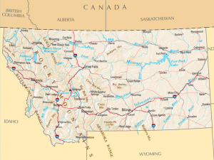
The drive to Havre was 1-hour 45 minutes north on US-87, a predominantly 1-lane road amidst the ruralness of the Great Plains. The speed limit was 70, which seemed way too slow. Slow vehicles could cause temporary traffic. However, they were easy to pass, since there were rarely vehicles in the southbound lane. The scenery was barren, but beautiful, especially since this was my first time immersed within the Plains. The highway passes through 3 very small towns where the speed limit precipitously drops to 60, then 45, then 25, and then returns upward in the same progression. Yet, the brief speed reduction provided a change of scenery that added character to the drive.
I typically don’t like long drives. However, this drive was surprisingly relaxing, because unlike typical Atlanta drives, there wasn’t traffic, there weren’t traffic lights, it wasn’t stop and go, and there was a plentiful natural landscape.
Once arriving in Havre, I stayed at the Best Western Plus Havre Inn & Suites. I have stayed in fancy, very expensive hotels. Yet, the room I had at the Best Western rivaled any of them. The room was huge, with a capacious bathroom. I had a couch, chair, and tables. Moreover, the room was clean, the service friendly, and there was ample free parking and a decent free breakfast. The only thing missing was a room safe and an extra roll of toilet paper, the latter of which I corrected quickly after speaking to the amiable front desk staff.
Yet, since there wasn’t a safe and the hotel had me sign a document at check-in absolving them of responsibility for missing items, to minimize risk I declined room service each day via using the “Do Not Disturb” sign. Nevertheless, I HIGHLY recommend the Best Western to anyone visiting Havre.


Since Montana is on Mountain Time, I still had time for dinner. Per the suggestion of the front desk staff I walked .4 miles to the Bow & Marrow on Highway 2, the main road in downtown Havre and the main east-west road/highway throughout the Northern Montana Hi-Line.
The Bow & Marrow specializes in beef. Grade A steaks can cost as much as $85 for the 32 oz. “Tomahawk Chop” or $58 for a 16 oz. ribeye. I went with the $18 “Yellow Jacket Burger,” comprised of a ½ lb. burger, bacon, hash browns, pepper jack cheese, and an egg. I also had a side of broccoli. The burger was very good, although I would have preferred it more medium and juicy. The broccoli was delectable, cooked perfectly. In addition, Samantha (Sam), my waitress, provided outstanding service to this out-of-towner dining alone.
After returning to the hotel, I read for about an hour and then crashed for the night so I could be rested for a rigorous physical day on Tuesday.


Breakfast at the hotel was functional, albeit certainly not fancy. I had scrambled eggs, a bagel, yogurt, and a banana.
Upon returning to my hotel room and preparing for a trail run I noticed my American Express card was missing. I figured I probably left it at the Bow & Marrow, where I was one of the last diners. Thus, I sent the Bow & Marrow an email from their website. I also looked up the restaurant’s number and gave them a call, figuring nobody would answer, since they don’t open until 4 pm. What do you know? An answering service picked up and politely took a message.
Within 10 minutes I had a call and a text from Bow & Marrow owner Shaina Hofeldt. Shaina offered to promptly drive to the restaurant to look for the card. I thanked her, but said, “No rush, I have other cards… I can meet you when you are going to be there within your normal schedule.” She told me 1 pm. Therefore, we agreed she would look for the card at 1 pm and then give me a call and text.
After completing some CPT emails I headed out to Bill Baltrusch Nature Trail. The Trail and adjacent parkland is named for Bill Baltrusch (1929 – 2017), the founder of Bill Baltrusch Construction, a builder of roads, homes, and commercial buildings in Hill County and the surrounding area. Once entering the Trail and walking about a ¼ mile there are 2 options: 1) turn left to take a .7 mile paved trail or 2) turn right to take a 2.6 mile unpaved loop. My decision was expedited by 2 nice locals who were eager to assist me. Upon their guidance, I ran the 2.6-mile loop and then ran around the adjoining neighborhoods for a total of 4.5 miles.
The run was pleasant, except for the grasshoppers. Northern Montana is known for plentiful numbers of Northern Grasshoppers.[4][5][6] At the beginning of the run it was like a horror movie. Everywhere I stepped a horde of grasshoppers attacked me. It was like Alfred Hitchcock returned to film “The Grasshoppers,” in lieu of directing “The Birds-2.” Fortunately, the insect swarm didn’t bite. Rather, they jumped at high speed then bounced off, which stung and itched. As the run progressed, I was glad to move away from the brush, whereupon there were fewer grasshoppers.


After completing my run I drove to the North Central Senior Citizens Center on 2nd Street in Havre, where the Department of Fish, Wildlife, and Parks communicated a presentation entitled, “Bears on the Hi-Line.” Bear management and education specialist Wesley Sarmento discussed how to differentiate a grizzly bear from a black bear (muzzle, hump, claws, ears), behavioral differences between the bear species, dietary differences, their range within Montana, where they tend to spend their time (within forests and along waterways), how to prevent bear encounters, how to keep bears away from residences, what to do when/if encountering a bear, how to use bear spray, and why bear spray is superior to a firearm. Wesley and his assistants were excellent presenters and brought beneficial visual aids, including PowerPoint slides, bear hides, bear skulls, and bear spray canisters- the latter 3 of which we could touch at the conclusion of the presentation.
The only surprising part of the presentation was Wesley’s opinion that Montana should allow a grizzly bear hunting season to prevent ursine expansion. Grizzlies are currently a protected species. In Wesley’s opinion the success of the grizzly population endangers humans as the bears encroach upon human populated land.
However, as an animal lover I take the opposite view. I believe humans have inequitably encroached upon land that historically belonged to wildlife. Humans either need to learn to live together with bears or we should move away from wilderness areas.
At one time there were more than 50,000 grizzly bears in the lower 48 states. Human expansion and associated habitat depletion, livestock depredation, hunting, and trapping reduced the population to less than 1,000 and eliminated the grizzly in California, Arizona, Utah, Oregon, and New Mexico. Yellowstone National Park and, since 1921, the State of Montana have been at the forefront of grizzly bear recovery.[7]
The Northern Continental Divide Ecosystem in Montana, which comprises Glacier National Park and adjoining lands, now contains an estimated 1,000 grizzly bears. The total resurgence collectively in Montana, Wyoming, Idaho, and northeastern Washington is an estimated 1,800 bears, most of which reside within 5.7 million acres of designated recovery zones. However, since grizzly bears became federally protected in 1975 via the Endangered Species Act, the State of Montana has increased its populations of humans by 250,000. Moreover, as the bear population continues to expand, more bears are migrating outside the recovery areas. Consequently, bear-human encounters have increased, whereby hunters, ranchers, and some politicians propose controlled hunting, whereas environmentalists support nonviolent means of bear control.[8][9][10][11][12]


At the conclusion of the presentation, I spent about 20 minutes talking with one of Wesley’s FWP assistants. We talked about Montana, hiking, bears, and bear spray. Of note, I asked him if it was OK to transport bear spray home on an airplane. He showed me a special container they use to transport bear spray canisters. However, he was uncertain whether one could transport bear spray within checked luggage, although he believed it was allowed. This conversation will become relevant during Day 7.
After the bear presentation I headed to The Lunch Box. As the name implies, The Lunch Box serves an outstanding lunch. I had a large and delicious roast beef, turkey, and provolone sandwich, with some chips. For dessert I had blueberry pie. Without a doubt, the Lunch Box’s blueberry pie was the best I’ve ever partaken. I had an incredible lunch and dessert for less than $17- and every dollar was well spent. I HIGHLY recommend The Lunch Box.
Furthermore, I was extremely impressed with the server. The place was packed. She was the only server. Whereas many workers would whine and complain, with a smile she motored at high-speed the entire time I was there. You could hear the floor pound from the energy of her movement, as if she was a much heavier person, which belied her lean physique. There was definitely purpose in her gait.
By the end of my lunch the crowd reduced a bit, whereupon she spent a few minutes to inform me about places to see and things to do in Havre. She also told me a bit about the culture. I appreciated her hard work and the conversation. I hope she kicked butt with tips. She deserved it. I know she got a nice tip from me.
At 1 pm, Shaina arrived at the Bow & Marrow, instantly found my Amex card, and then texted me. Apparently, the previous night, upon paying the bill I forgot to pull the card out of the black folder. I speedily drove to the restaurant to retrieve the card.
Shaina is awesome! We conversed for about an hour about her life journey from Havre to Long Beach, CA; to owning a restaurant in Salt Lake City; and then returning to her family roots in Havre, marrying, raising a family, and purchasing and remodeling the Bow & Marrow. She misses aspects of Long Beach and Salt Lake City, but prefers the slower pace of Havre for her marriage, children, and restaurant. We had a great conversation! And I am usually quiet with strangers!
Everyone I have met thus far in Havre is very nice, very approachable, and very real, without pretentiousness. Havre residents appear very different from city people- or country people in the South. I couldn’t imagine a Havre resident telling me, “Bless your heart!”
After picking up some Gatorade from the town Walmart and answering CPT emails- “all play and no work leads to an unproductive day”- I prepared for my first real Montana hiking excursion.
The hike was in the Bear Paw Mountains within Beaver Creek Park. The northern tip of Beaver Creek Park starts 10 miles south of Havre on Highway 234 and extends another 17 miles southward. The Park encompasses a total of over 10,000 acres, which makes Beaver Creek Park the largest county park in the United States. Recreational activities available within the Park include hiking, fishing, berry picking, snow shoeing, cross country skiing, sledding, picnicking, and camping.[13] The park terrain includes mountains, grasslands, Bear Paw Lake, Lower Beaver Creek Lake, and Beaver Creek.[14]
Although Beaver Creek Park is maintained by the Hill County Park Board, maintenance is not funded by tax dollars, but by usage fees, such as daily or annual park permits, campground reservation fees, cabin rental fees, haying fees, and cattle grazing fees.[15] Day permits cost $10. Annual permits cost $55.[16]
The Bear Paw Mountains cover approximately 800 square miles, 20 miles north-south and 40 east-west.[17] Bear Paws, as the locals call it, is a prairie island range, which means the mountain geography occurs apart from associated larger ranges or sub-ranges.[18] The tallest mountain within the range is Baldy Mountain, with a height of 6,916 feet at the summit. The mountains are surrounded by grassy range, man-made lakes/reservoirs, and a creek.[19]
Since I couldn’t obtain a permit to hike Baldy Mountain, due to Native-American restrictions, I hiked Mount Otis. The Mount Otis hike consisted of a 1.9-mile non-looped trail, with 705 feet of elevation gain. The trail is predominantly rocky, with some wildflowers and vegetation at the bottom, and a beautiful 360° view at the 4,741-foot summit.[20][21] The temperature was in the 90s, as temps were about 10° higher than normal for this time of year. Given the heat and the need for altitude acclimation, Mount Otis was a semi-challenging opportunity to complete a “warm-up hike” for the more challenging treks in Glacier Park during the end of the week.


Walking around Havre I could clearly see the presence of the Native American population. Arising from interest in the Native American culture, during dinner I researched the integration and insularity of the nearby Native-American community.
Montana is home to a total of 8 Native-American reservations- Flathead, Blackfeet, Little Shell Chippewa, Rocky Boy’s, Fort Belknap, Fort Peck, Crow, and Northern Cheyenne. 2 of the reservations, Rocky Boy’s and Fort Belknap, are proximal to Havre. Rocky Boy’s Reservation, situated 28 miles south of Havre contains members of the Chippewa and Cree tribes. Fort Belknap, situated 79 miles east of Havre, contains the Gros Ventre and Assiniboine tribes.[22]
The 122,000-acre Rocky Boy’s Reservation houses about 2,500 members from amongst the total of 6,177 enrolled members of the Chippewa-Cree tribes. The local reservation economy includes wheat farming, post and pole production, operation of the Bear Paw Ski Bowl, schools, the Bureau of Indian Affairs, Indian Health Services, tribal government, operation of the Northern Winz Casino in Box Elder, and Plain Green Loans,[23] a subprime consumer lending company. In addition, the Reservation contains a 2-year community college, Stone Child College.[24][25]
The 652,000-acre Fort Belknap Reservation houses 3,429 members from amongst the total of 6,693 enroll members of the Gros Ventre and Assiniboine tribes. The primary industry is agriculture, particularly cattle ranches and alfalfa hay. Other employers and industries include the Bureau of Indian Affairs, the tribe, the tribal-owned Little Rockies Meat Packing Company, buffalo ranching, and tribal licensed and guided hunting. The Reservation contains a 2-year community college, Aaniih Nakoda College.[26]
The prominent presence of the Native American people and culture is a sharp contrast to Georgia, which is one of 14 states without federally designated reservation land.[27][28][29] 6.6% of Montana’s population is Native American.[30] The concentration is higher in Havre, where 12.1% of the population is Native American.[31] In comparison, only 0.3% of Georgia’s population is Native American.[32]
After a breakfast of eggs and potatoes, I took the Tour of Underground Havre- “Havre Beneath the Streets.”
In a Google search, “cities with an underground,” I accessed a Wikipedia article entitled, “Underground City.” The Wikipedia article by country lists cities with “subterranean spaces” for refuge, living, employment, commerce, transit, pedestrian tunnels, cellars, or cisterns. The article lists 28 underground cities within the USA. Most are large cities, such as New York City, Houston, Dallas, Philadelphia, Washington, D.C., Boston, Minneapolis, Detroit, Cleveland, Chicago, Atlanta, Seattle, Kansas City, and Oklahoma City.[33] Who would have thought that 1 of the 28 would be Havre, Montana?
 Havre is Montana’s 10th largest city, with a population of 9,362 in the 2020 census.[34][35] Havre was founded as a railroad town in 1893.[36] Railroad magnate and owner of the Great Northern Railway James J. Hill envisioned Havre as an opportune midpoint between the railroad’s route from Minneapolis-St. Paul to Seattle. Havre remains the county seat of Hill County, named after James J. Hill, who also has a statue in his honor at the town’s Amtrak station. Moreover, until the latter part of the 20th century Great Northern Railway (now Burlington Northern Santa Fe) was Havre’s largest employer.
Demographically, Havre is 82% white, 12% Native American, 5% mixed race, and 1% other races. The median value of homes is $163,300. 28.7% of adults have a college degree. The median household income is $50,635. The poverty rate is 15.2%. The temperature is semi-arid, with winter average highs in the high-20s to low-30s and summer temps in the mid 80s,[37] although the week of my visit we were in the 90s.


Underground Havre, known as “Havre Beneath the Streets,” originated in January 1904 after a large fire destroyed much of downtown Havre.[38] While the city was being rebuilt, above ground businesses operated underground.[39] The underground museum preserves artifacts from many of the old businesses, including a saloon (of which there were many in Havre, which was a rugged railroad and cattle town), opium den (of which at least 3 existed in the city), laundry, brothel, hotel, restaurant, pharmacy, doctor’s office, bakery, law office, and accountant’s office.
One can reserve tickets online or purchase them at the Frank DeRosa Railroad Museum on 3rd Avenue in downtown Havre.[40] The Railroad Museum is free, but the Havre Beneath the Streets Tour costs $17. The tour meets at the Museum and then traverses the underground passageways that housed the post-fire businesses. For those into history I recommend first traversing the railroad museum, which has an excellent exhibit on James J. Hill, then taking the underground tour. The underground exhibits were excellent and well-maintained, plus the tour guide provided an outstanding presentation that enhanced the experience. Although $17 is more than I would expect to pay for a 90-minute tour, I’m sure it’s expensive to prepare and maintain the exhibits.


Lunch was again at The Lunch Box, which is across the street from the Railroad Museum. Lunch included an apple pie, which was exceptional. Yet, no pie I’ve ever tasted matched the blueberry pie I had at The Lunch Box the day before.
I then traveled to Bear Paws to hike Eagle Rock. Eagle Rock is listed on the Beaver Creek Park map, but isn’t listed on All Trails. The hike had 2 steep ascents, was longer than the Mount Otis hike, and was practical in conditioning me for longer, steeper, and higher hikes later in the week.


Once returning to Havre, I worked on an article I’m writing regarding biodetection and law enforcement canines. The article covers research studies regarding the abilities of biodetection dogs, considerations for the optimal training of scent discrimination dogs, the biology of scent detection, how local law enforcement purposefully or inadvertently cues dogs to produce an alert behavior, and types of alert behaviors. In addition to providing valuable referenceable information to the general public, the article will be helpful in educating CPT’s trainers when preparing seizure alert and diabetic alert service dogs and in my role as an expert witness during motions to suppress.
Breakfast at the hotel for some reason tasted better than on Monday and Tuesday. After breakfast and some emails it was time to head to the Wahkpa Chu’gn Buffalo Jump.
The Wahkpa Chu’gn Buffalo Jump is situated off Highway 2 West, just 2 minutes from the hotel, behind the Holiday Village mall. The cost is $15 for adults. There are reduced prices for seniors and children. The Wahkpa Chu’gn Buffalo Jump is an archaeological site that claims to host the most extensive and best preserved Native American buffalo jump in the USA.
Prior to viewing a placard outside the hotel and visiting the site I was unaware of buffalo jumps. Basically, before Indians acquired rifles, they would frighten a herd of buffalo or a segregated group within the herd to run away from the Indian hunters. Using the placement of rocks, natural landmarks, and people they would direct the herd to run off a cliff. Resultantly, a majority of buffalo would die or become unconscious, stunned, or orthopedically immobile. Then, hunters awaiting at the bottom of the cliff would use bow and arrows, atlatls (spears), tomahawks, or clubs to en masse kill the injured or deceased buffalo. Females within the tribe would then butcher and process the dead buffalo for meat, hides, fat, and other uses.[41]
A local archaeologist, John Brumley, found the Wahkpa Chu’gn site by observing knives, stoneware, and buffalo bones along the banks of the Milk River, which runs in an east-west direction north of downtown Havre and parallel to the railroad tracks. Over 3 years the local Archaeological Society then excavated the site. The current exposition includes weapons, arrowheads, buffalo bones, cooking tools, paintings, plaques, and actual archaeological excavations. A tour guide explains the process of the buffalo jump, which enabled Indians to kill more buffalo in a short time than with other hunting strategies.[42]


Afterward, I checked out at the Best Western. While checking out I spoke at length with a Native American desk clerk, who lives outside the reservation, but previously resided at Fort Belknap. He said he is mixed tribe, a combination of Crow, Cree, and Asinniboine. He was very open and cordial in his discussion of reservation life and cultural issues pertinent to Native Americans. In his opinion, it is safer living in Havre than on the reservation. Additionally, he stated there are more employment and higher-educational opportunities off the reservation.
In Georgia, the cultural and economic issues of Native Americans barely earn a mention. However, the minorities relevant to political and economic discussion are different in Montana.
Before heading west toward the Rocky Mountains, I commenced one last hike near Havre. Bear Paws Nature Trail is in the south end of Beaver Creek Park.[43] Bear Paws Nature Trail is a 7-mile out and back trail crossing hay fields, aspen groves, raspberry bushes, juneberry bushes, and Beaver Creek until reaching the border of Rocky Boy’s Reservation.[44] The trail follows a logging haul road created in the late-1800s by soldiers from Fort Assiniboine.[45][46] Although literature claims wildlife (turkey, deer, antelope, elk, birds) is plentiful- and I’m sure it is- I didn’t see any wildlife, other than an antelope while driving to the trail. All Trails states the Trail is 5.5 miles up and back, whereas Visit Montana more accurately states the distance is 3.5 miles each way, 7 miles total. The elevation is 1,220 feet.[47] There are campgrounds adjacent to the trail and along the trail multiple placards explain the history, flora, and fauna. Given that the temperature was in the 90s, the tree canopy provided welcome cooling. The terrain is mostly flat, but provides excellent views, while the length of the trail provides a reasonable distance for trail running or hiking.


After completing the hike, I grabbed a bite to eat, and then headed 1.5 hours west on Highway 2 to Shelby, MT, which was going to be my starting point for hiking the Rocky Mountains. The drive on Highway 2 was long, but pleasant. Although the road is just one-lane, I rarely saw other drivers and could easily pass them. The speed limit is 70 mph, other than 2 times when passing very small towns, whereupon the speed limit drops to 60, then, 45, then 25, before returning gradually to 70. Driving in Montana is much different than driving in Atlanta.
While in Shelby I stayed at the Comfort Inn & Suites Gateway to Glacier National Park. Check-in was smooth. However, once entering the room I could see I was spoiled at The Best Western. The room was much smaller than my Best Western room and lacked some of the furniture. Moreover, the bathroom was small, with the vanity outside the shower and toilet, which is practical perhaps when 2 people use the room, but creates a miniscule, claustrophobic bathroom for one person. In addition, the sound prevention was minimal. I couldn’t hear much outdoors, but I could hear everybody walking in the hallway or exiting a room. In contrast, I couldn’t hear a thing at The Best Western. Yet, on a good note, the room was clean and had everything I needed.


Shelby is the county seat of Toole County, MT, located about 30 miles south of the Canadian border and 80 miles east of Glacier National Park. Despite Shelby’s role as the county seat, the “city” is small, only 5.8 square miles, with a population of only 2,875 according to the 2020 US Census and 3,304 according to the City of Shelby website. The population is 83% white, 10% Native American, 4% Hispanic, 2% mixed race, and 1% black. The median household income is $44,250, with 10.3% of residents living below the poverty line. The median value of a home is $155,500. However, 9% of homes are larger, having a value of over $400,000. 86.8% of adults graduated high school, but only 21.1% graduated college with a 4-year degree. Unemployment is only 2.2%. Shelby has an Amtrak stop and is a location for the Burlington Northern Railway.[48][49] Yet, Shelby’s relevance occurs principally due to its location at the intersection of I-15, a major US north-south interstate, and Highway 2, the major east-west road along the Montana Hi-Line, which also was its relevance to me, as Shelby was a convenient stopover before hiking the Rocky Mountains.
Breakfast at the hotel was OK. Scrambled eggs, yogurt, a bagel, and a banana. Montana hotel breakfasts have been decent, but bland. No pancakes, vegetables, tropical fruit, or fresh oatmeal. Yet, breakfast was included in the room rate. Therefore, eating at the hotel was the right decision.
After breakfast I completed emails, then headed to the Town Pump to meet a friend, who has been a Montana resident for the last few years. While at the Town Pump, I bought a sandwich, vegetables, several bananas, and multiple Gatorades to eat and drink on the trail.
My friend recommended hiking Swift Dam Reservoir. Swift Dam is about 1 hour and 15 minutes from Shelby. We took Front Street/Highway 2 in Shelby to I-15 South. After about 14 miles, we took Exit 348 to Highway 44 West through Valier for about 31 miles. Then, went south for 8 miles on Highway 89 to Dupuyer, whereby we turned right onto Swift Dam Road. Swift Dam Road is an 18-mile gravel road that leads to the trailhead. The trip had no traffic and took us through some quaint small towns and several huge ranches.
Swift Dam is a 205-foot high, 573-foot-long dam in Pondera County, Montana, west of Dupuyers and south of the Blackfeet Reservation. The dam has an interesting history. Swift Dam was originally completed in 1914 as a 157-foot high, privately owned earthfill, rockfill, and concrete structure to create from naturally flowing Birch Creek a 31,000 acre-feet reservoir that facilitated irrigation for reservation and non-reservation land.[50][51] However, on June 8, 1964, an uncharacteristically intense, high-precipitation, 36-hour storm dropped 12-16 inches of rain upon already saturated soil and an atypically high snowpack. Resultantly, the dam spillways exceeded capacity, water carried over the top of the dam, dam buttresses eroded, and the dam failed. The dam collapse and subsequent flood directly killed 19 persons. The nearby Two Medicine Dam also failed about 8 hours after the collapse of Swift Dam. Related downstream flooding killed an additional 9 people.[52]
The local Pondera Canal and Reservoir Company rebuilt the dam as a concrete-arch structure in 1967.[53] Fortunately, the dam has remained sturdy since its reconstruction. The dam and adjacent Swift Reservoir provide beautiful hiking and camping. However, Pondera does not allow any other form of recreation in the area.[54][55]
Once reaching the parking lot we changed into hiking boots, grabbed our backpacks, and commenced to the trailhead. We began at an elevation of 5,000 feet on the marked trail. We started on the trail for the Swift Reservoir Loop, which is a 7.2-mile moderate trail around the reservoir.[56] The trail starts with a mild climb up a 7% grade to an elevation of 5,186 feet along the reservoir.[57]
Then, for 2 reasons we converted to a makeshift trail. First, we wanted to climb up a steep ascent. Second, the north side of the Swift Reservoir Loop requires a $20 permit from the Blackfeet Reservation, as the north end of the Reservoir is on Blackfeet territory.
Thus, we veered left off the Loop to ascend up a 27% unmarked grade that took us to Hurricane Ridge Peak. The climb to Hurricane Ridge was steep, passed through an area of trees destroyed by fire 2 years previous, and then converted to very loose, rocky, terrain. However, the journey remained highly scenic from start to finish, as the terrain switched from forest to burnt forest to rock. Interestingly, we had no cell phone reception at the bottom, but had excellent reception when we reached 7,115 feet at the top of Hurricane Ridge.[58] The climb was steep, challenging, invigorating, and provided a sense of accomplishment when reaching the summit.
The descent was challenging to avoid sliding on loose rocks. During the descent, once reaching flatter terrain beyond the burnt trees, close to the reservoir and dam, we saw a black bear running in the distance. We temporarily proceeded cautiously to prevent an inadvertent, proximal encounter with the bear.


Our return to the parking lot at 6 pm meant an end to an incredible day of hiking. Yet, it also meant a respite for weary legs.
Upon reaching Shelby I returned to the hotel, while my friend drove onward to his Montana home. Once entering the room, I stripped off clothes to take a welcomed shower. I had amassed a lot of dirt and dust after the all-day hike in forest and rocks.
Once feeling fresh and putting on clean clothes, I searched for an optimal place for dinner. Shelby does not have many choices. By researching Google and querying the hotel desk I settled upon The Alibi Lounge, a bar/restaurant at the center of town. The waiter was outstanding in refilling my water and making suggestions from the menu. After reviewing the menu and listening to the waiter’s recommendations, I selected the house salad and a pepperoni and mushroom pizza. The salad was very good and surprisingly the pizza was exceptional! I was born in Brooklyn and lived most of my youth in New Jersey. Therefore, I know good pizza. The Alibi’s crust was crispy and tasty. The sauce had the right aroma and taste. There was plenty of delectable mozzarella cheese and the pepperoni and mushrooms were top notch. There isn’t much restaurant competition in Shelby. Thus, it is very easy to recommend The Alibi Lounge to anyone visiting Shelby.
Once completing dinner, I returned to the hotel room to write CPT email replies, then went to bed. Saturday I would hike in Glacier National Park.
Breakfast at the hotel was OK. Scrambled eggs, yogurt, a bagel, and a banana. The breakfast was functional, but far short of phenomenal.
After breakfast I stopped at the Shelby Town Pump to get gas and to ready my backpack for hiking in Glacier National Park. Unfortunately, the Shelby Town Pump didn’t have bananas, so I made an extra stop at the Albertson’s in Cut Bank.
During the drive, I passed through Browning, MT. One has to drive through Browning when entering Glacier National Park’s eastern entrances.[59]
Browning, founded in 1895 and incorporated in 1919, is named after Daniel M. Browning,[60] who in 1895 was the U.S. Commissioner of Indian Affairs.[61] Thus, the town is not named after a Native American. Yet, it is the Agency Headquarters for the Blackfeet Indian Reservation and has been since 1895.
The Blackfeet are Montana’s most populous tribe. Glacier County’s website boasts about the town’s cultural offerings, especially Faught’s Blackfeet Trading Post and the Museum of the Plains Indians. Meanwhile the official Browning website features its casino. As a matter of fact, the entire home page is dedicated to roulette gambling at the casino.
I elected to enter the Park at the Two Medicine Entrance. Other entrance options required reservations, whereas Two Medicine accommodates more spontaneous people- like me. The drive was a total of 1 hour and 20 minutes that started west on Highway 2 for 71 miles and then north at East Glacier Park Village onto Highway 49 for 5 miles, until making a left onto 2 Medicine Road, driving 3 miles, and reaching the Park entrance.
Seven-day admission into the Park cost $35 for one vehicle.[62] The guard station wasn’t staffed. Therefore, I paid by cash using a self-service kiosk. Credit card payment was also an option by writing card information onto an envelope and then depositing within the box slot at the kiosk.
Once paying, I drove about 1 mile to the first hiking option, Running Eagle Falls Nature Trail.[63] The Trail has a bathroom alongside the parking lot and bear-proof trash canisters. Unfortunately, from a hiking standpoint Running Eagle Falls was disappointing. The trail was brief, only .6 miles total out and back, flat, and crowded.[64] However, Running Eagle Falls at the end of the Trail made the hike worthwhile. There is also an adjoining nature walk at the start of the trail, where placards explain the natural flora of the park and their utility for Native American sustenance.


The real hikes started about another mile west on the entrance road.[65] And it got “real” pretty fast.
The parking lot for Scenic Point Trail is on the left side of the entrance road. The Trail is very challenging. The base altitude is 5,200 feet. The elevation increase is 2,352 feet over a hike of 3.9 miles one-way and then 3.9 miles back that takes about 3.5 – 4.5 hours to complete,[66][67][68] depending upon the physical condition and altitude tolerance of the hiker. The first half of the hike is highly challenging, as it is constantly pitched upward, with few flat areas. The views are magnificent, including the view of the mountain goat who in the early part of the hike stopped to eat vegetation just 5 feet from me. Due to the difficulty-level, the hike is not crowded. Moreover, mid-August temperatures were in the low 90s and there is no tree cover after the first 15 minutes, which certainly discouraged some potential hikers. Yet, I enjoyed the challenge. For those into steep physical hikes, I HIGHLY recommend Scenic Point Trail.


After completing Scenic Point, I next drove to the parking lot by Two Medicine Lake, whereby I walked along the south shore of the lake to the trailhead for Cobalt Lake. Interestingly, some of the north shore trails were closed due to a ranger sighting a grizzly bear proximal to an animal kill.


Cobalt Lake Trail is 5.8 miles, a total of 11.6 miles up and back, with an elevation gain of 1,400 feet.[69] The trail starts flat, but veers slightly upward after passing a suspension footbridge that allows only one person at a time, due to the swaying. The elevation increase later becomes steeper after passing Rockwell Falls.[70][71]
Due to wanting to make it back to Shelby before nightfall, I hiked only about 3.5 miles into the trail- a total of 7 miles. The trail was a nice change of pace after climbing Scenic Point. There was tree cover throughout. Furthermore, the brisker speed without elevation increase provided a nice contrast to the steep climb at Scenic Point. Cobalt Lake may have been boring without first completing Scenic Point. Nevertheless, I recommend Cobalt Lake as a nice forest hike, with elevation changes at the end, and water views by Two Medicine Lake, Rockwell Falls, and Cobalt Lake.
At the midpoint of the hike, I returned to the trailhead with a hiker named Aaron, who since Covid has been working remotely as a software designer, while simultaneously hiking the country’s national parks. Aaron is traveling with his dog. However, although Glacier Park allows dogs at camp sites, the Park does not allow dogs on trails. Therefore, Aaron seemed glad to have someone to accompany him and keep conversation, especially since we both maintained a similarly rapid pace.


Once reaching the Two Medicine Campstore alongside the south shore parking lot, I purchased some bottled water and sugar-free green tea. No more Gatorade. Drinking Gatorade during hikes was a mistake I will never repeat. From now on I will bring a camelback filled with water. The combination of altitude, sun exposure, physical exertion, and high sugar from Gatorade created an upset stomach the day before at Hurricane Ridge and again today at Scenic Point. Thus, the toilets at the bottom of the mountains were very much appreciated, although I don’t know whether the toilets appreciated me. And the day before, during the Hurricane Ridge climb, I’m glad my friend brought baby wipes, which is something I will always do in the future when climbing in high altitude and hot weather- just in case.
After drinking the tea, using the restroom, and relaxing my stomach, I said “Goodbye” to Aaron and started my drive back to Shelby. I planned to stop in East Glacier to eat fried chicken at a place advertising “the world’s best huckleberry fried chicken.” However, my stomach was not ready for food. Montana is known for its delectable huckleberries[72] and Juneberries, [73] many of which I ate wild while hiking. I’m sure huckleberry fried chicken would have been delicious, especially if it was the “world’s best.” However, I preferred to maintain a calm stomach while sitting in the car for an hour and a half.
Once reaching the hotel, I was exhausted. Therefore, I elected to crash early without eating dinner. This way I would be fresh for tomorrow’s plane ride home.
To maintain a calm stomach, breakfast at the hotel consisted of scrambled eggs, toast, a banana, and loperamide (Imodium), which I picked up early in the morning at the Shelby Albertson’s. Imodium was a wise choice. My stomach felt great throughout the entire travel day.
Before departing for the airport, I reviewed economics and real estate information pertinent to opening a service dog kennel in Montana.
Montana is very different from Georgia. Montana is the USA’s 4th largest state in land area and total area, behind only Alaska, Texas, and California. Comparatively GA is 24th in total area.[74]
Yet, Montana is only the 44th largest state in population, with 1.1 million people residing within the state. The least populated states are Wyoming (579K), Vermont (646.5K), Alaska (738K), North Dakota (800K), South Dakota (901K), and Delaware (1.01M). In contrast, Georgia is the 8th most populate state, with 10.9 million residents.[75]
Montana is the 3rd least densely populated state, with 7.42 residents per square mile. Only Alaska (1.28 per sq. mile) and Wyoming (6 per square mile) are less densely populated. To compare, Georgia is the 17th most densely populated state, with 190 people per square mile. New Jersey is the most populated state with 1,277 people per square mile.[76]
The largest industries in Montana are agriculture, mining, health care, forestry service, and energy production.[77] Montana’s GDP per capita is 42nd amongst the states. Georgia’s is 31st. Massachusetts has the highest per capita GDP and Mississippi the lowest.[78][79] Given the low population, Montana is 47th in total GDP, behind only Alaska, Wyoming, and Vermont. California is 1st and Georgia is 9th.[80]
Thus, Montana has a lot of land, without a lot of people or a lot of money chasing the land. Therefore, real estate should be inexpensive comparative to Atlanta, which might make Montana an excellent place to purchase land and build a service dog kennel.
Since I prefer to be proximal to a city with some activities and not too far from an airport, and since Montana only has one city (Bozeman) that is a direct commercial air route from Atlanta,[81] I researched real estate in Havre, Great Falls, and Bozeman. I ruled out Shelby due to the lack of activities.
Some online samples of real estate in Havre include a modern 2,500 square foot home on a 9.54-acre lot for $975,000; a 1,688 square foot home and horse ranch on a 20.1-acre lot for $699,000; a 3,080 square foot home on a 38-acre lot for $650,000; a 2,700 square foot home on a 4-acre lot for $390,000; a 2,300 square foot home on a 1.83-acre lot for $352,500; a 161.57 -undeveloped lot for $379,000; a 40-acre undeveloped lot with a lake for $270,000; and a 20.05-acre undeveloped lot for $180,000.[82]
Great Falls real estate compatible with a kennel project included a 4,000 square foot home on a 4.31-acre lot for $774,900; a 1,760 square foot home on a 2.2-acre lot for $545,000; a 34.41-acre undeveloped lot for $1.2 million; and a 16.01-acre undeveloped lot for $1.49 million.[83]
Bozeman real estate compatible with a kennel project included a 4,600 square foot home on a 20-acre lot for $3.795 million, a 5,090 square foot home on a 3.8-acre lot for $3.75 million, a 3,880 square foot home on a 19.4-acre lot for $2.998 million; and an undeveloped 14.52-acre lot for $1.25 million.[84]
An influx of Californian emigres has dramatically driven up Bozeman real estate prices[85][86][87][88][89] and to a smaller extent real estate prices in Great Falls. Thus, the few people chasing land theory is not applicable to Bozeman.
From the standpoint of crime, Area Vibes rates Havre an F, with violent crime 84% above the national average and property crime 56% above the national average. Cost of living in Havre is given an A-, but employment is a D+ and schools a C-.[90]
Great Falls is similar. Crime is rated an F, with violent crime 18% above the national average and property crime 162% above the national average. Cost of living is a B+, with employment a D+ and schools a D+.[91]
In comparison, Bozeman is much safer and nicer. Crime is a B-, with violent crime 21% below the national average and property crime 31% below the national average. Cost of living is a D-, probably principally due to the cost of housing, while employment is a D+ and schools are an A+.[92]
According to National Weather Service data the weather is similar amongst the cities, with some minor differences. Summer July – August temperatures are 2 – 3° warmer in Havre, whereas winter temperatures are 5° cooler. However, Havre gets fewer rain days (90) than Great Falls (98) and significantly fewer than Bozeman (138). Moreover, Havre has notably fewer snow days (31) than either Great Falls (45) or Bozeman (54).[93]
Therefore, if we build a service dog kennel in Montana, the most likely spot is Havre, since the city meets project conditions, the real estate costs are the most reasonable by a large amount, crime can be mitigated by locating away from the city center, and weather conditions are more compatible with the needs of the business.
The drive from Shelby to Great Falls International Airport was pleasant. Hardly anyone was on I-15 on Sunday morning. Moreover, I-15’s speed limit is 80 mph, except proximal to Great Falls, where it reduces to 65- and I didn’t see one speed patrol during my 87-mile ride. The journey was basically a straight shot south on I-15, as the airport is only 4 minutes from the highway exit.
Just as nice, for convenience, there is a gas station on the entrance road to the airport. Therefore, filling the rental car tank was a breeze. Furthermore, the rental return was rapid. The parking lot is immediately adjacent to the terminal and I had zero wait at the Enterprise counter. There is something to be said for small airports. The day appeared to start with great karma.
I arrived at the airport at around 11 am MDT for a 1:20 pm flight to Salt Lake City. I had a carry-on with my electronics and personal items and promptly checked two bags at the Delta counter, a duffel bag packed with used clothes and hiking shoes and a backpack I acquired for my longer hiking trips. Inside the backpack I secured a can of bug spray and bear spray. After checking my 2 bags, I then proceeded to the TSA Precheck line.
It was about 11:15 am and the line had not opened for the day. I was going to be the first checked passenger. I couldn’t imagine that in Atlanta.
Then, after 15 minutes of waiting, karma changed. Two TSA officers called my name. I said, “That’s me.” They asked if I packed bear spray in one of my bags. I replied, “Yes, I was told it is allowed in checked baggage.”
They then asked me to follow them. They took me downstairs, through the Delta counter, and into the luggage inspection area. I said, “What’s the big deal? If it’s not allowed, just remove it from the bag.”
They replied, “It’s a big deal.”
I was then politely interrogated for about 30 minutes, as they filled out multiple reports and awaited TSA upper-level approval for me to fly. I am glad I got to the airport early.
During the interrogation they informed me I could be fined. I responded truthfully that I was told by a trusted law enforcement official that it was probably OK to fly with bear spray in checked baggage, but not carry-on luggage. Therefore, I followed the guidance of a person I trusted as knowledgeable.
The TSA officers informed me it is never OK to fly with bear spray, either in carry-on or checked bags. They explained, if the spray somehow releases due to pressure problems, heat, or a malfunctioning cap it would affect the health of passengers in the cabin area, which made sense, although the probability is very very low.
I asked how manufacturers ship the product. The TSA officers responded, “In a cargo plane, not a passenger plane.”
The experience appeared overdone for an innocent error. Yet, the officers were very polite, never threatening, and explained they have necessary protocol. I therefore remained very polite and cooperative.
Plus, since they talked with me in the luggage inspection area, I saw they had not much else to do beyond thoroughly inspect the very few bags that awaited passage. It was about 12 noon and there were only about 5 checked bags for the whole morning, including my 2 bags- for the entire airport. Flying in Great Falls is much more relaxing than flying in Atlanta, unless one packs bear spray.
After about 30 minutes they said I was cleared to fly. I hope this incident doesn’t affect my Global Entry and TSA Precheck. Regardless, even though I solicited advice from a reputable source, I should have checked online before flying with checked bear spray. Unfortunately, the online information is somewhat disparate.
According to Executive Flyers, the TSA says one can bring bear spray on a plane in checked bags, provided the canister is less than 4 ounces and the spray is less than 2%. However, certain airlines, including Delta, have more stringent rules, where they don’t allow bear spray, regardless of the size or concentration.[94]
Most bear spray is 1.4 – 2% capsaicin and related capsaicinoids.[95] Most canisters sold are between 7.9 – 9.2 ounces, as a smaller canister is unlikely to contain enough pressure or chemicals to affect a charging grizzly bear.[96][97][98]
In contrast to the Executive Flyer article, the TSA website is very succinct. “Bear Spray: Carry-On Bags- No; Checked Bags- No.”[99] I write the preceding to hopefully prevent someone else from duplicating my mistake.
What is a mistake? Answer = information. So, I learned something. Yet, hopefully not at the expense of a fine.
After receiving my clearance to fly and a quick walk through the Precheck security station, I waited to board my flight from Great Falls to Salt Lake City. Fortunately, karma returned for the remainder of the day.
The flight to Salt Lake departed and arrived on time. Again, I had to check my carry-on. However, it arrived promptly at the jetway upon the completion of the flight.
The interlude between flights in Salt Lake was relaxing. With no Gatorade and the addition of Imodium, my digestive system was feeling better than it had in 2 days. Therefore, I ate lunch at Garbanzo Mediterranean Fresh.
Garbanzo is a Middle Eastern version of Chipotle. The food is tasty and healthy. Given that I was hungry and still concerned about the potential of an upset stomach, a Garbanzo bowl was an excellent choice. Surprisingly, there are only 28 Garbanzo locations in the USA, one of which is at Salt Lake City Airport and another at Hartsfield-Jackson Airport in Atlanta. Interestingly, there are no other Garbanzo locations in Utah or Georgia beside the airport locations.[100] I am rooting for an increase in Garbanzo franchises.
I then boarded my Delta Comfort aisle seat to Atlanta. While in the gate area and at the commencement of the flight I started writing this article, while my trip was still fresh in memory. However, needing the internet for footnote research, I then switched to watching Godfather 2, because “this is the business I have chosen.”
The flight arrived on time, whereupon my Delta app quickly informed me of the carousel that would contain my bags. I will say it again, the updated Delta app is awesome. We read frequently about how understaffing is causing problems with lost luggage. Therefore, it is comforting to promptly know when my flight is departing, section is boarding, bags are loaded onto the airplane, and bags are placed on a conveyor at baggage claim. Plus, the app checks me in, loads my boarding passes into Apple Wallet, and stores boarding passes and itineraries. Everyone flying Delta should create an account on the Delta app.
On the negative side, the Park’n Ticket bus took a while to arrive. I am loyal to Park’n Ticket because they are the first off-airport parking site when I arrive near the airport, their pricing is reasonable, their people are friendly, they pick me up fast once I park, they give a free bottled water when I depart, and they have a nice loyalty program, with free parking for frequent use. However, I frequently get annoyed when I wish to return home and see 2 – 3 shuttles from the other parking companies before I see 1 Park’n Ticket shuttle.
OK, I vented. At least once arriving at my car the Sunday midnight ride home was smooth, with minimal traffic.
In summary, I had a great trip to Montana. I accomplished relevant real estate objectives, got to see the Great Plains, experienced a relaxing rural lifestyle, learned about Native American culture, and hiked beautiful Rocky Mountain trails. I look forward to the opportunity to revisit the Montana wilderness- and perhaps to construct a service dog kennel outside of Havre.
[1] Friedman J, “The 10 Most Congested Cities in the U.S.,” U.S. News & World Report, Oct 13, 2020.
[2] Lockert, M, “2021 Top 10 Cities with the Worst Traffic in the U.S.,” Metromile, Sep 27, 2021.
[3] “2021 Urban Mobility Report,” Texas A & M Transportation Institute, Mobility Division, 2022.
[4] “Grasshopper Outbreaks and Management Options 2022,” USDA Agricultural Research Service
[5] O’Neill R and Wanner K, “Grasshoppers, Grasshoppers, They’re Everywhere,” Big Sky Small Acres, Montana State University Extension.
[6] “Northern Grasshopper- Melanoplus Borealis,” Montana Field Guide, MT.Gov.
[7] “All About Bears,” Montana Wildlife & Parks
[8] “Montana Seeks to End Protections for Some Grizzlies, Which Would Allow Hunting of Bears for the First time in Decades,” CBS News, Dec 7, 2021.
[9] Keefer V, “Growing Grizzly Populations Breed Excitement and Uncertainty in Montana,” The Conservation Fund, July 6, 2021.
[10] Murray D, “Change in Administration Won’t Necessarily End Federal Efforts to Delist Grizzly Bear Protections,” Great Falls Tribune, Nov 30, 2020.
[11] Chaney R, “Grizzly Managers Gather for New Bear Numbers,” MontanaRightNow.com, May 16, 2022.
[12] “Grizzly Bear Population has Grown, So Have Conflicts,” Char-Koosta News, The Official News of the Flathead Indian Reservation, Jan 20, 2022.
[13] “Discover Beaver Creek Park.”
[14] “Bear Paws Mountains,” Havre Chamber of Commerce.
[15] About the Park, “Discover Beaver Creek Park.”
[16] Park Permits, “Discover Beaver Creek Park.”
[17] “Bear Paws Mountains,” Havre Chamber of Commerce.
[18] “Island Ranges,” Wikipedia.
[19] “The Bear Paws Mountains,” BigSkyFishing.com
[20] “Mt. Otis Trail,” All Trails.
[21] “Otis Mountain,” Mountcarta.
[22] “Tribal Territories in Montana,” Montana State University.
[24] “Chippewa Cree Tribe,” Governor’s Office of Indian Affairs.
[25] “Northern Winz Hotel & Casino Ownership/Management,” Casino City- Your Guide to Gaming Excitement.
[26] “Fort Belknap Indian Community,” Governor’s Office of Indian Affairs.
[27] “Federal and State Recognized Tribes,” National Conference of State Legislatures, 2022.
[28] “States with no Indian Reservations,” AAA Native Arts, 2022.
[29] “States with no Tribes,” Tribal Institute, 2022.
[30] “Quick Facts- Montana,” United States Census Bureau, July 1, 2021.
[31] “Havre, Montana Population 2022,” World Population Review, 2022.
[32] “Our Indigenous Population: Focusing on Native Americans,” Atlanta Regional Commission, 2020.
[33] “Underground City,” Wikipedia.
[34] “Top 360 Cities in Montana by Population,” World Population Review, 2020.
[35] “Quick Facts, Havre City, Montana,” United States Census Bureau, July 1, 2021.
[36] Jenks J, “Commercial Development of Havre, Montana (1889 – 1959),” National Register of Historic Places Continuation Sheet, United States Department of the Interior, National Park Service, 2009.
[37] “Summary of Monthly Normals: 1991 – 2020,” US Department of Commerce, National Oceanic & Atmospheric Administration, August 27, 2022.
[38] Doll K, “Havre and the Fire of 1904,” Havre Daily News, December 14, 2018.
[39] “The Underground City- Havre Beneath the Streets.”
[40] “Havre Beneath the Streets,” Central Montana, 2022.
[41] “Mass Kills,” Texas Beyond History.
[42] “Wahkpa Chu’gn Buffalo Jump- Learn History of Site.”
[43] Beaver Creek Park Map,” Discover Beaver Creek Park, 2022.
[44] “Bear Paw Nature Trail- Beaver Creek Park,” All Trails.
[45] “Bear Paw Nature Trail,” Havre Chamber of Commerce.
[46] “Bear Paw Nature Trail,” Visit MT.
[47] “Bear Paws Nature Trail,” The Outbound.
[48] “Shelby, MT,” Census Reporter, ACS-2020.
[49] “Community Profile,” City of Shelby, Montana, 2022.
[50] “Swift Dam,” Wayback Machine.
[51] “Swift Reservoir Topographic Map,” AnyplaceAmerica.com, 2022.
[52] Mauney L, “Case Study: Swift and Two Medicine Dams (Montana, 1964),” Lesson Learned from Dam Incidents and Failures, Association of State Dam Officials, 2020.
[53] “Pondera County Canal and Reservoir Company,” Wayback Machine, 2010.
[54] “About Swift Dam Montana,” DBPedia.
[55] “Swift, Gibson Dams Offer Hikers Spectacular Views,” Choteau Acantha 203-2014 Visitors Guide, p. 19.
[56] “Swift Reservoir Loop,” All Trails, 2022.
[57] “Swift Reservoir Trail #143,” Hiking Project.
[58] “Hurricane Ridge Peak 7115,” Montana,” Peakbagger.com, 2022.
[59] “Map,” Plan Your Visit, Glacier National Park, National Park Service, Department of the Interior, 2022.
[60] “Browning, MT,” Travel Information, Glacier County, Montana, 2022.
[61] DeJong D, “Paternalism to Partnership: The Administration of Indian Affairs, 1786- 2021,” Chapter 14- David M. Browning, University of Nebraska Press, 2021.
[62] “Glacier National Park- Fees & Passes,“ Glacier National Park Montana, National Park Service, US Department of the Interior, 2022.
[63] “Running Eagle Falls,” Hiking in Glaicier.com, 2022.
[64] “Running Eagle Falls Trail,” All Trails, 2022.
[65] “Two Medicine Valley Trails- Destinations and Elevation Change,” Glacier National Park, National Park Service, Department of the Interior, 2022.
[66] “Hiking Two Medicine,” Glacier National Park, National Park Service, Department of the Interior, 2022.
[67] “Scenic Point,” All Trails, 2022.
[68] “Scenic Point,” Hiking in Glacier.com, 2022.
[69] “Hiking Two Medicine,” Glacier National Park, National Park Service, Department of the Interior, 2022.
[70] “Cobalt Lake,” All Trails, 2022.
[71] “Cobalt Lake,” Hiking in Glacier.com, 2022.
[72] Shetler S, “Huckleberries in Montana are Everywhere! In the Wild and In Your Food,” Quirky Travel Guy, July 20, 2022.
[73] Caplette J, “Juneberries in July,” Distinctly Montana.
[74] “United States by Area,” World Population Review, 2022.
[75] “US States Ranked by Population- 2022,” World Population Review, 2022.
[76] “United States by Density- 2022,” World Population Review, 2022.
[77] “What are the Biggest Industries in Montana?”, World Atlas, 2022.
[78] “Per Capita Real Gross Domestic Product (GDP) of the United States in 2019 by State,” Economy & Politics, Statista.
[79] “Per Capita Real GDP by State, All Industry Total, 2021,” Institute for Policy and Social Research, University of Kansas, data from US Bureau of Economic Analysis, and US Census Bureau, Vintage 2021 Population Estimates.
[80] “GDP by State 2022,” World Population Review, 2022.
[81] “Nonstop Flights from Atlanta- ATL Direct Flights,” Nonstopfrom.com, 2022.
[82] “Havre, MT Real Estate & Homes for Sale,” Realtor.com, September 5, 2022.
[83] “Great Falls, MT Real Estate & Homes for Sale,” Realtor.com, September 5, 2022.
[84] Bozeman, MT Real Estate & Homes for Sale,” Realtor.com, September 5, 2022.
[85] NBC Montana Staff, “Study Tracks Californians Moving to Montana,” NBC Montana, February 1, 2022.
[86] Wolf D, “Californians Continue to Fall in Love with Montana, Especially Bozeman,” xlcountry.com, July 23, 2021.
[87] Cote T, “Are Californians Trying to Change Montana?”, Tedcote.com, January 27, 2018.
[88] The CE Shop Team, “Why Does Montana Have the Most Inbound Moves in the US?”, Real Estate Agent Blog, The CE Shop, March 7, 2022.
[89] McLean T, “Californians are Arriving in Montana in Droves. But They’re Not Welcome,” SFGate, July 22, 2021.
[90] “Havre, MT Crime” Area Vibes, 2022.
[91] “Great Falls, MT Crime” Area Vibes, 2022.
[92] “Bozeman, MT Crime” Area Vibes, 2022.
[93] “NowData- NOAA Online Weather Data,” National Weather Service, National Oceanic and Atmospheric Administration.
[94] “Can You Bring Bear Spray on a Plane?” Executive Flyer, August 22, 2022.
[95] “Interagency Grizzly Bear Committee- Bear Spray Position Paper,” USDA.gov
[96] “What You Should Know About Bear Spray,” Alaska Department of Fish and Game
[97] Nolan A, “The 7 Best Bear Sprays of 2022 to Keep You Safe,” Safety & Insurance, Trip Savvy, June 22, 2022.
[98] “Is Pepper Spray the Same as Bear Spray,” National Parks Backpacker, March 21, 2021.
[99] “What Can I Bring?- Bear Spray,” Home-Travel-Security Screening, Transportation Security Administration,
[100] “All Locations,” Garbanzo Mediterranean Fresh, 2021.

Need to get in touch with CPT? I’ve got you covered.
Pick what works best for you!


